A few days prior, I had been hiking in San Jacinto State Park with Jeremy when we took a wrong turn and came into view of a beautiful snow filled cirque and face. We noticed that the north facing slopes in particular looks really filled in. And it looked steep. In short, it looked like fun skiing. So when I got home, I looked on some topo maps and determined it was Tahquitz Peak that we were looking at. And I noticed that a nearby trailhead looked to be in a well protected, steep northwest facing canyon. I thought, this has potential. So I went to check it out.
 |
| From the parking lot in Humber Park, Tahquitz Rock, or the western ridge of the peak, looms high. |
 |
| Just a few hundred yards up the trail, the snow bowls off the peak show just a bit of themselves. |
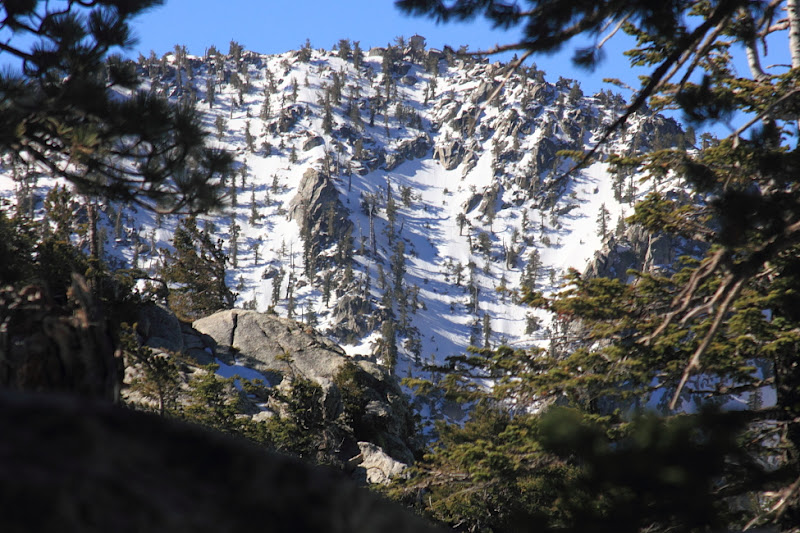 |
| The peak first comes into view. The fire lookout is clear, but the lines we wanted to ski are further looker's left. |
Conditons were less than ideal. The snow pack was thin. I was solo. But the good news was it seemed to have a solid overnight freeze die to the clear sky. The corn looked supportable. I headed up the summer trail in hikers and switched over to ski boots and skins at just under 8000 feet. From there, the skinning was near perfect. The north facing slopes were still a firm crust, but the east facing snow was perfectly softened for nice skiing. I followed the summer trail only as far as the ridge, as I wanted to turn along the ridge to get a better view of the lines I wanted to ski. The ridge had a few ups and downs, but it also afforded views of almost the entire run. The steeps looked plenty filled in, if a but spicy. The runout, which was still a steep run had snow, and it looked like I could ski to within a couple hundred vertical of where I had left the car at Humber Park. If the snow held up, it could be a go. About 500 feet from the final ridge that reached the summit, I cam across a deep valley and decided it was best to ski down and traverse lower, in the trees, where there was more snow.
 |
| Suicide Rock looms to the left of the trail, with views of Diamond Valley Lake in the distance. |
 |
| The second view of Tahquitz Peak, with the top of the ski line just coming into view. |
 |
| The line comes into view. |
The final push toward the summit had me wishing for more snow. The rock scrambling was exciting to say the least. I never made it past the final ascent, and decided to stop at the top of my line. The rocks had a very thin cover of snow, and a fall would have not been good. As for the skiing, the top 1000 feet was perfect steep corn. After that, the snow held up, but things began to tighten up. The ski turns became more and more interrupted by fallen leaf turns. Finally, it seemed too difficult to even wiggle through with the big skis I brought on this trip. It was the first time in a while that I wished I had my smaller, lighter get up. Anyway, the bushwacking seemed worse when I was doing it. But is was not long downstream before I found my car and lunch. This is a great line, but I hope to try again when there is a few feet of snow pack at 6500 feet. Then it would be pretty epic.
No comments:
Post a Comment
What do you think?